Altimeter: A device that measures altitude.
Ascent: The uphill portion or climb.
Backpacking: Multi-day treks carrying all necessary equipment.
Base Layer: Clothing worn directly against the skin for temperature regulation.
Bearing: Direction from one point to another in degrees.
Belay: A technique to secure a rope in climbing.
Blaze: Mark indicating the path of a trail.
Bivouac (Bivy): A temporary camp or shelter without a tent.
Bothy: A basic, often free shelter found in remote areas.
Cairn: A human-made pile of stones, used as a trail marker.

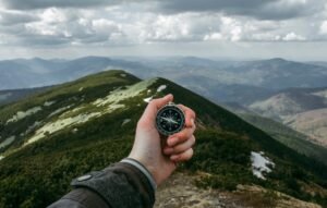
Compass: Navigation tool for determining direction.
Contour Lines: Map lines showing shape and steepness of terrain.
Crampons: Metal spikes for better traction on icy terrains.
Cross-Country: Walking off established trails.
Daypack: A backpack for short day trips.
Descent: The downhill portion of a walk or hike.
Elevation: Height above sea level.
Exposure: Risky location due to steep terrain or sheer drops.
False Summit: A deceptive point appearing to be the mountain’s top.
Gaiters: Coverings for lower legs and footwear for protection.
GPS (Global Positioning System): Provides location and time from satellites.
Grade: Classification indicating difficulty of a walking route.
Knoll: A small hill or mound.
Leave No Trace: Ethics for preserving nature by minimizing impact.
Munro: A Scottish mountain over 3,000 feet.
Navigation: Planning and following a route.
Ordnance Survey (OS): National mapping agency for Great Britain.
Pacer Beads: Counting system for tracking distance travelled.
Path: A marked or well-trodden route.
Peak Bagging: Activity of reaching summits of specific peaks.
Pitch: Climbing section between two belay points.
Ravine: A deep, narrow gorge.
Ridge: Elevated section of terrain with steep sides.
Saddle: A low area between two peaks.
Scrambling: Mix of walking and climbing without special equipment.
Summit: Highest point or peak of a hill or mountain.
Switchback: Zigzag path up a steep incline.
Topo Map: Map showing terrain features.
Trailhead: Starting point of a trail.

Trekking Poles: Poles for balance and reducing strain during walking.
Waterproofing: Making something resistant to water.
Waymarking: Signs indicating the route of a path.
Windchill: Perceived decrease in temperature due to cold air flow.
Yomp: A long, hard walk or military march with equipment.
Zero Day: A rest day with no distance covered.
Hi there! I’m the Editor, experienced outdoor development specialist, mountaineer and the mind behind ‘Country Rambler.’ I’m thrilled to welcome you to our website, your go-to destination for all things hill walking and rambling. Whether you’re an experienced adventurer or just dipping your toes into the great outdoors, I’ve got you covered. From providing guidance on essential gear, like boots and jackets, to sharing trail tips that range from peaceful paths to challenging peaks, I’ve got everything you need to embark on your next adventure. Stay in the loop with our fresh news updates and trail information. So, lace up those boots and join me as we explore the breathtaking landscapes together. Happy wandering!


